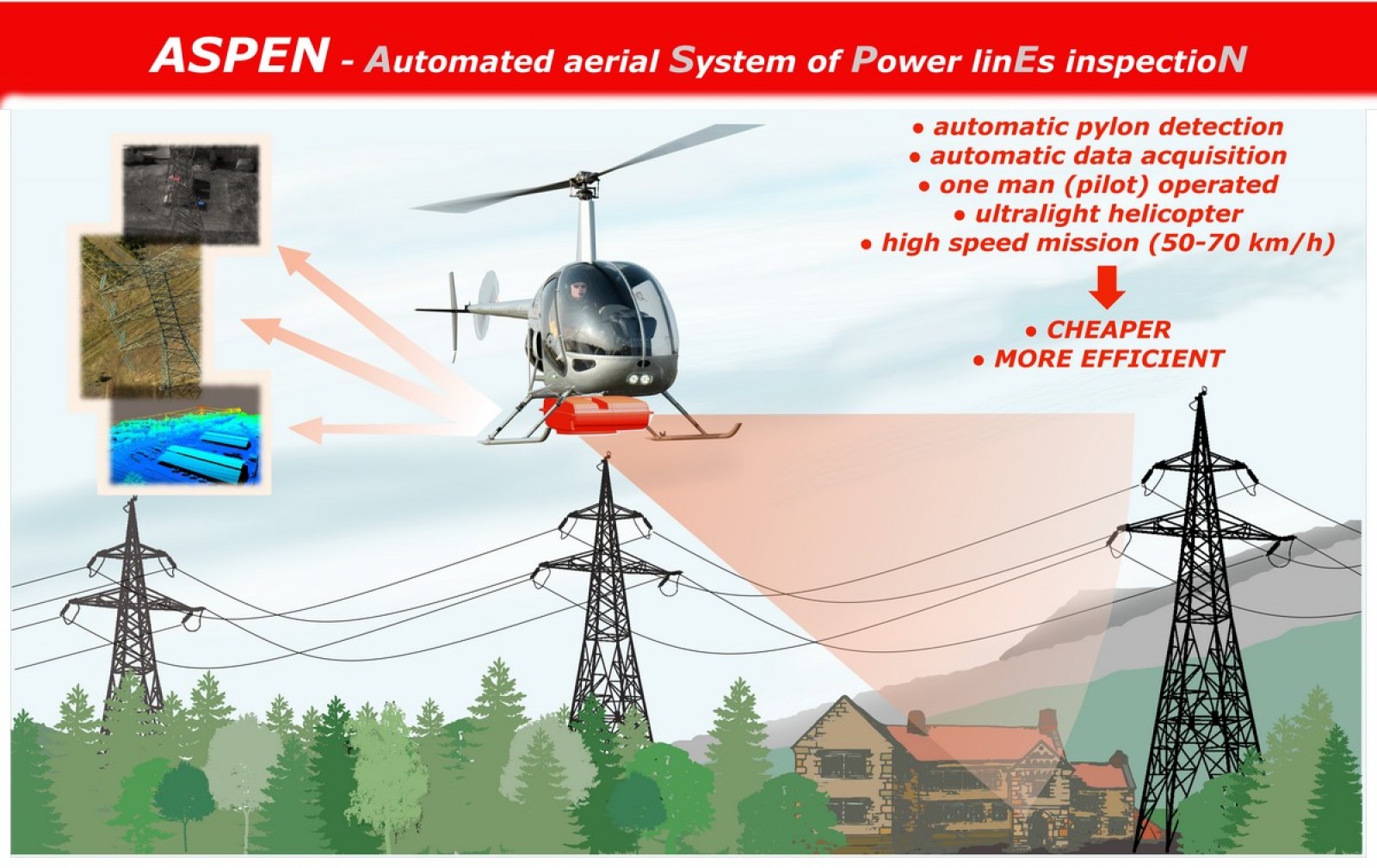
A highly automated aerial system of data acquisition (image, video, lidar) for inventory, monitoring, documenting and evaluating the technical condition of the HV and MV power lines and pylons.
Key elements of the system are:
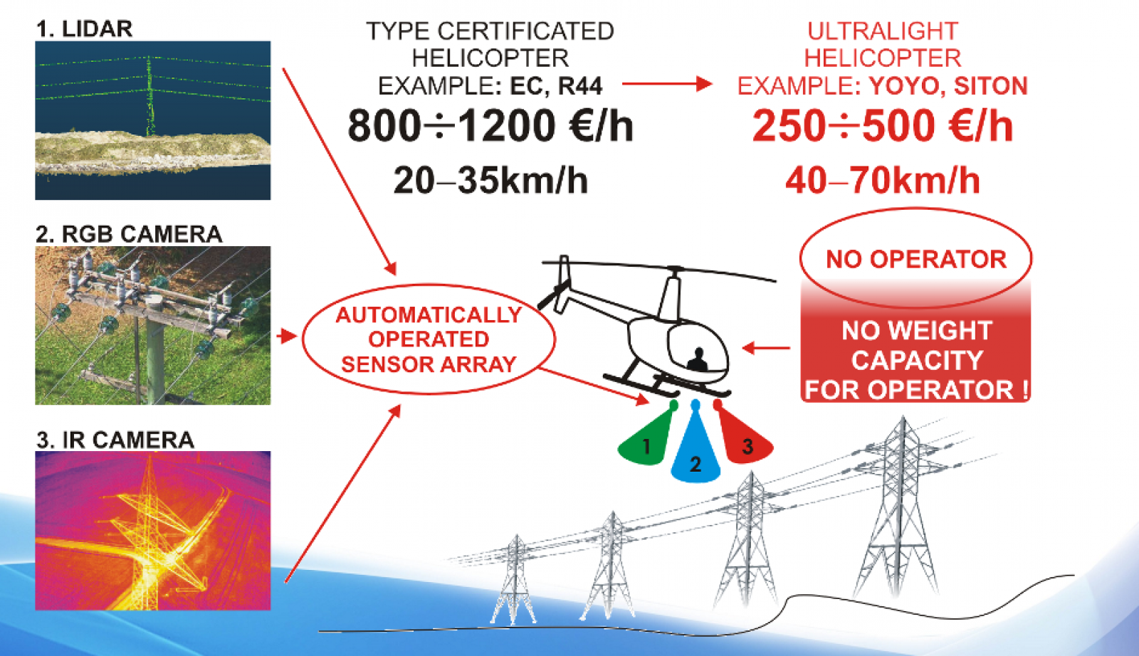
- sensor module for data acquisition, consisting of:
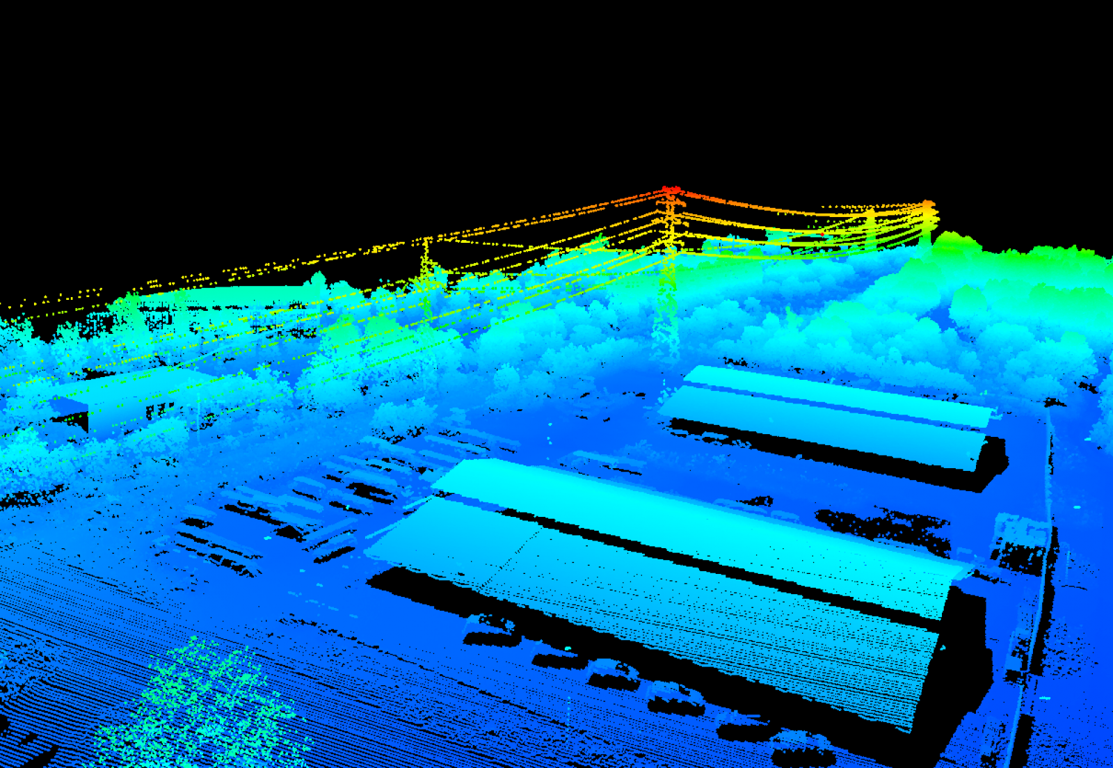
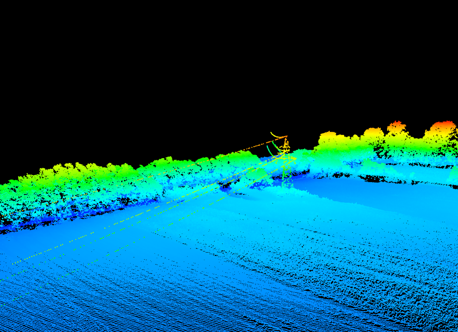
- a lidar scanner - VUX-1 Riegl
- RGB inspection cameras - 2x Hasselblad A6D
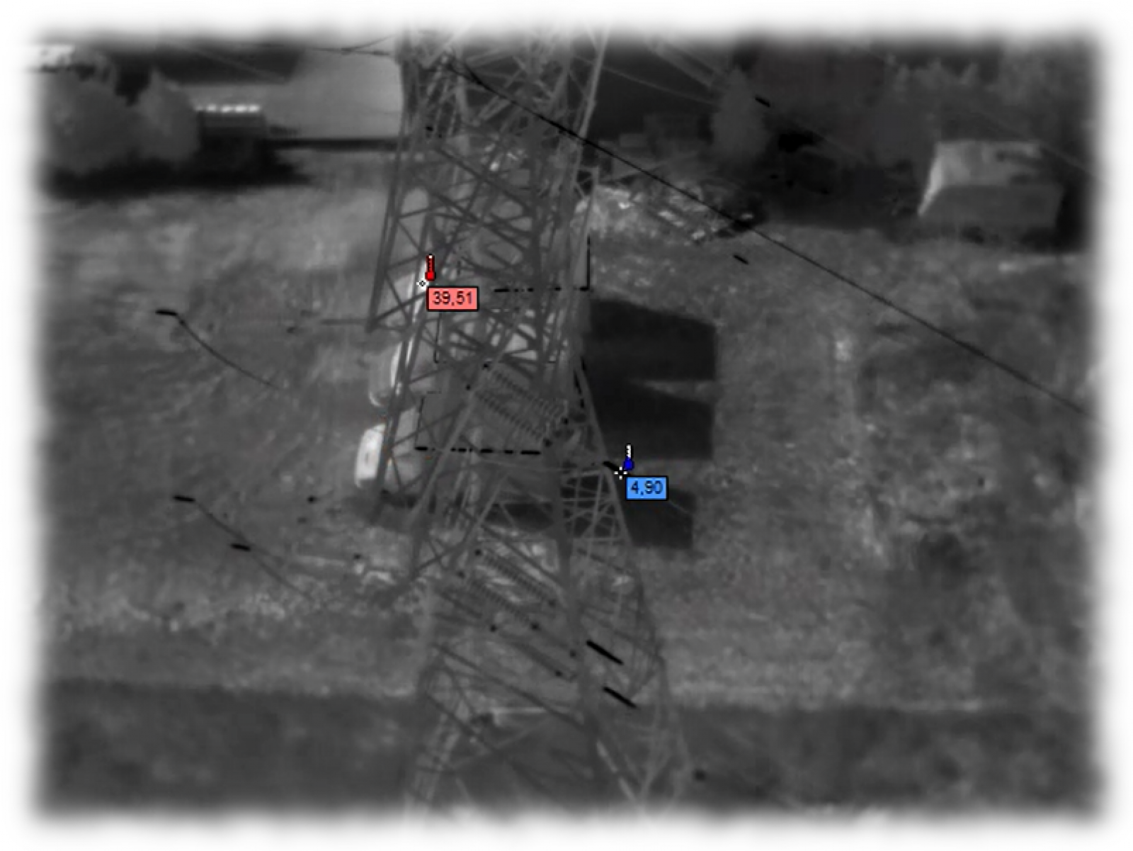
- thermal inspection camera - 2x FLIR a65
- nadir RGB camera (photogrammetric)
- a pylon detection module, which - on the basis of the RGB cameras - recognizes the power pylon’s position and gives indispensable parameters to the module controlling the set of sensors
- set of sensors’ control module including also the control function of the acquired data
All system modules are integrated in the box platform, mounted underneath an ultra-light helicopter.
Mission and data parameters:
- flight speed during mission: 50-70 km/h
- flight height during mission: 150 m AGL
- point cloud density: 20-30 ppm
- inspection image ground resolution: 2-4 mm
Mission characteristics:
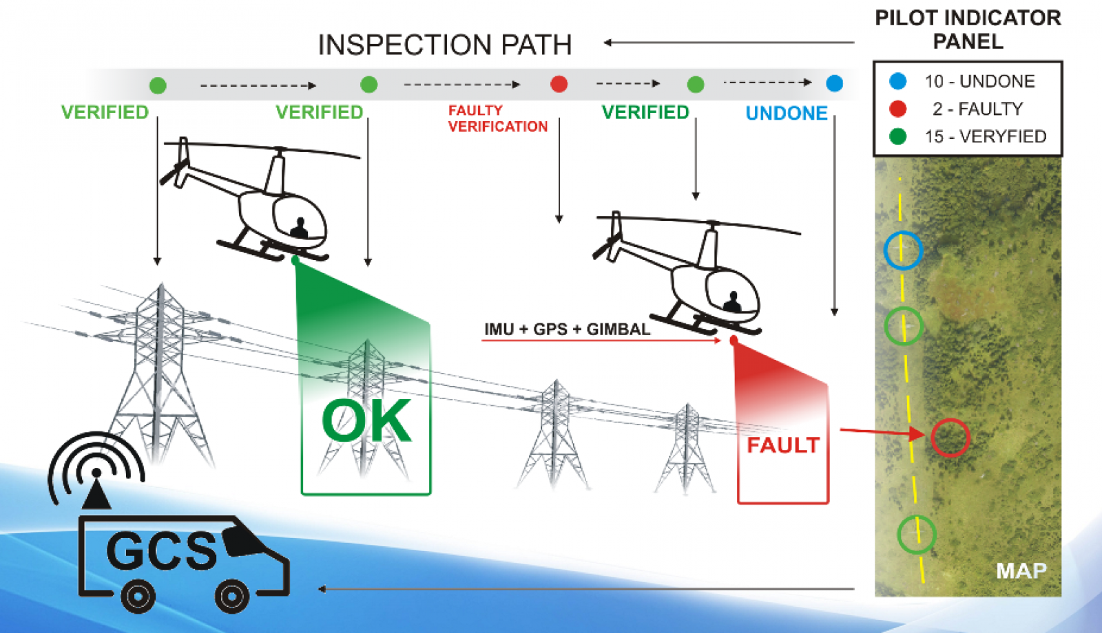
The pilot controls the constant speed of the helicopter (without cyclical hovering), maintaining the flight height of 150 m AGL.
The pylon detection module detects subsequent power pylons (regardless terrain cover) along the flight path. It identifies coordinates of the pylons and forwards them to the sensors' control module, which directs RGB and thermal inspection sensors towards the pylon. Inspection sensors, which are gimbal suspended, constantly take images of the pylons and power lines. Acquired data are verified immediately by the data control module for pylon location accuracy and the image taking fact. If the pylon is not imaged then the helicopter pilot receives an appropriate message on the mission panel and he can return the helicopter to acquire correct data for the faulty pylon.
Lidar point cloud and nadir RGB images are collected constantly along the mission path.
A service car accompanies the mission. The ground personnel has an insight into mission parameters and can advice a helicopter pilot in crucial moments (flight path corrections, meeting/landing location, etc.). The ground personnel plans a meeting/landing site to refuel the helicopter between flights and to exchange system battery and storage media.
The ASPEN system capabilities:
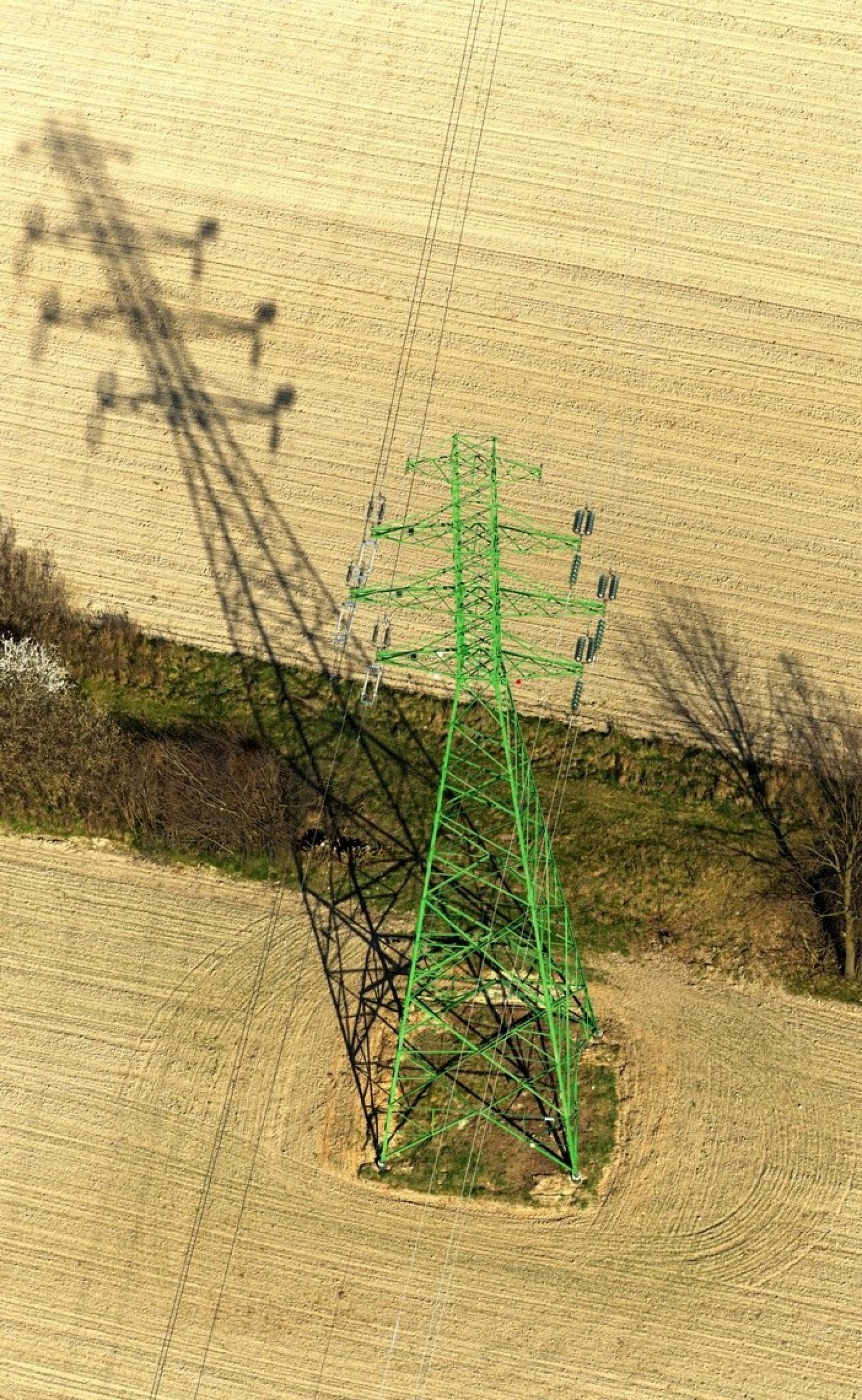
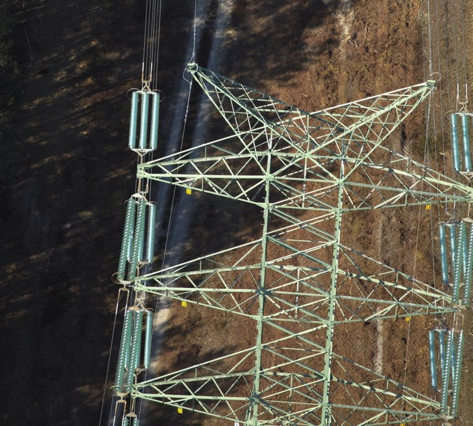
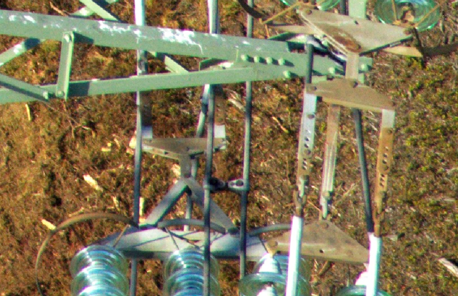
- the accuracy of the photos taken is adequate to identify damages such as: breakage of individual wires of the high voltage wire; nut losses; cracks in the load-bearing elements of the pole; rusty numberplates; etc.
- enables determination of overhangs of high-voltage wires and identification of overnormative distances of greenery or other objects to the power line
- the ability to transmit video images from the mission on-line to ground control station or another computer in any part of the world - which is important eg. in the case of the mission immediately after the occurrence of a natural disaster
Advantages of the ASPEN system:
- ultra-light helicopter - cheaper, more ecological
- one man (pilot) operated - cheaper
- constant flight speed - doubled efficiency
- all data types collected simultaneously - cheaper, more efficient
- all data with the same time stamp - ease of integration, processing and analysis
- power lines inspection (not only pylons) - unique
- ongoing data control - immediate reaction for the faulty situations - time saving and ensuring data completeness
- smooth flight at higher altitude - safety of the mission
- easy system installation - no interference in the helicopter structure required
- the system uses its own energy source - independent from the helicopter energy system